
学士
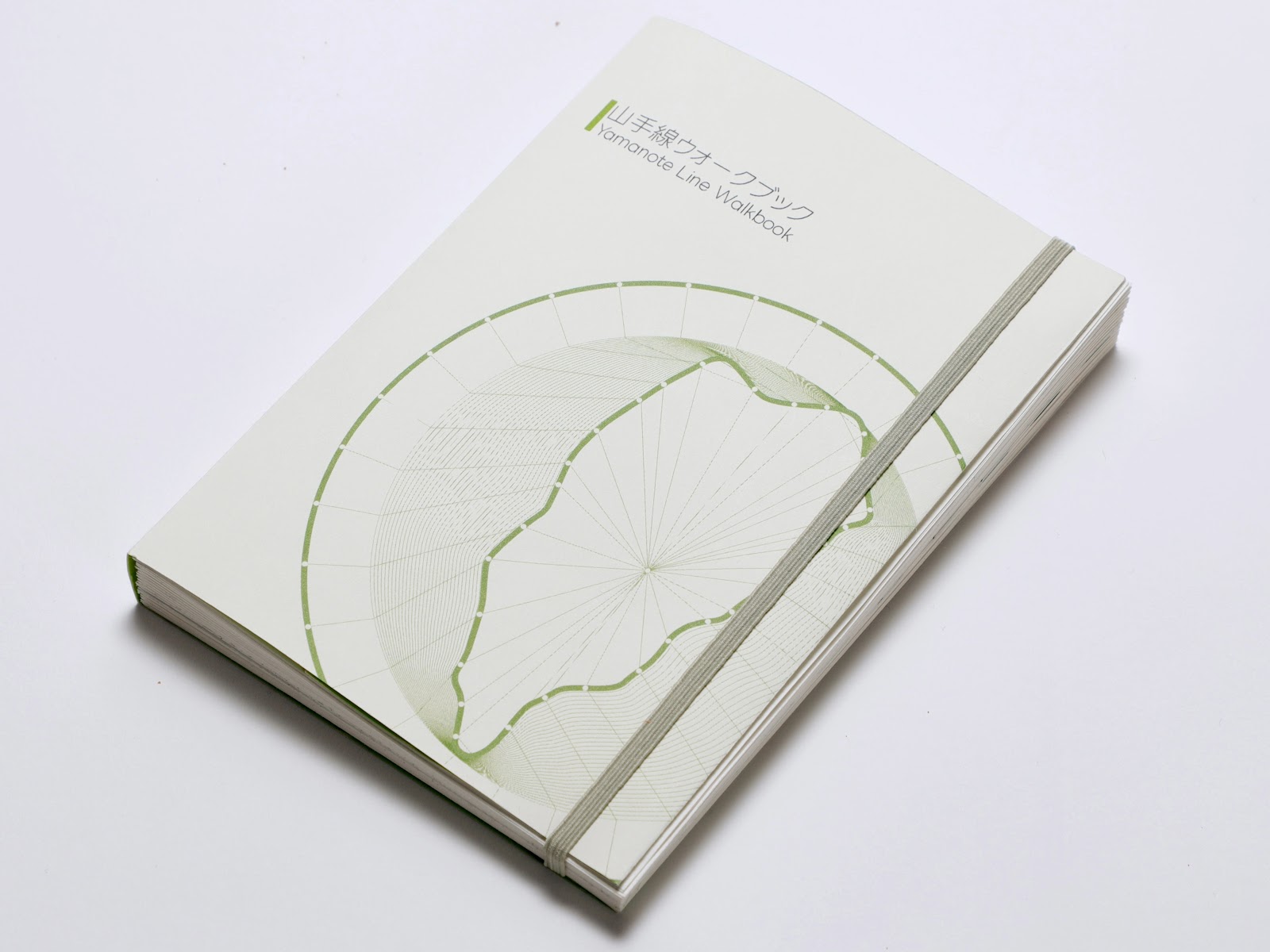
山手線ウォークブック
ヴィジュアルコミュニケーションデザインスタジオ
#グラフィックデザイン#ブックデザイン#インフォメーションデザイン
東京に住んでいても、街を深く知っているとは限らない。多くの人は電車で通り過ぎるだけで、地域の表情や距離感、細かな魅力に気づく機会が少ないという課題がある。
本書は、都心の象徴である山手線を徒歩で一周する体験を通して、東京の多面性と歩くことで発見する楽しさに気づくことを目的とした記録・体験型の書籍である。制作にあたっては、山手線沿線を複数回歩くフィールドワークを行い、歩行の体感や街の変化を継続的に観察・記録した。
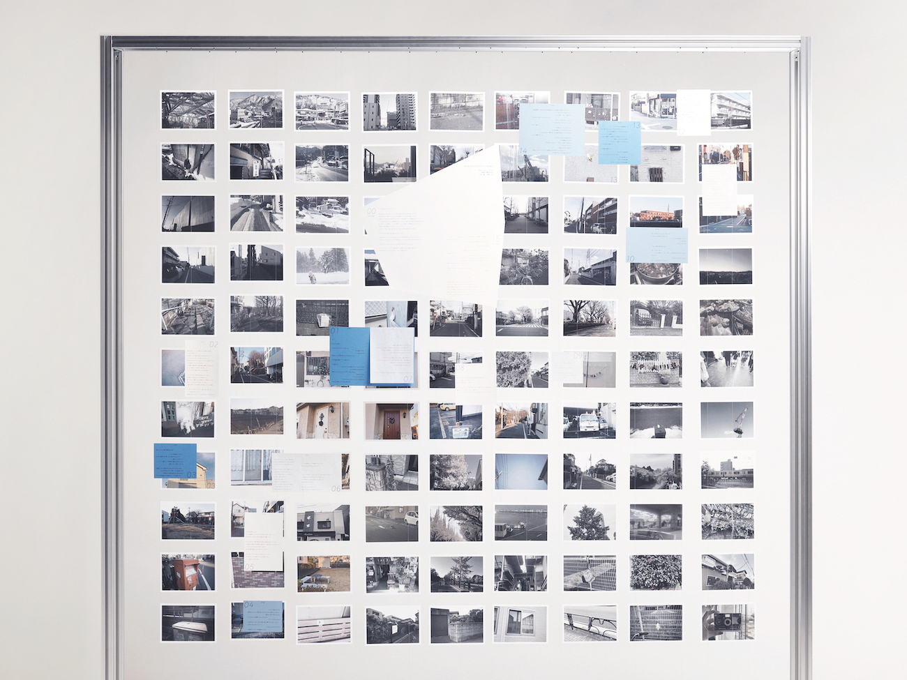
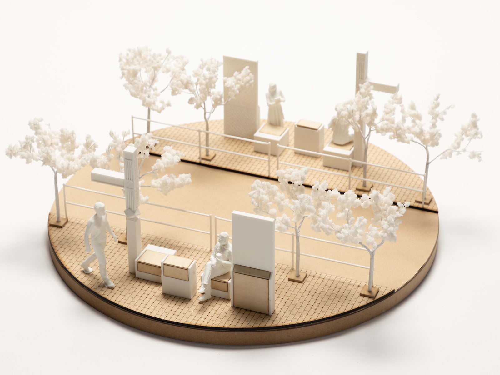
得られた体験やデータを、インフォグラフィックスの視点から再構成し、都市の特徴を直感的に理解できる地図として可視化した。各駅間の所要時間、歩数、標高といった計測データに加え、観察した植物や銅像、看板などの発見要素も取り込み、数量的情報と感覚的体験を横断する構成とした。
全15種のマップはB4サイズを4つ折りにし、持ち運びやすさと一覧性を両立させている。最終ページには読者が自由に書き込める欄を設け、歩く体験を自らの記録として重ねていける一冊とした。
Even for those who have lived in Tokyo for many years, opportunities to truly understand the city are surprisingly limited. Most people move primarily by train, simply passing through neighborhoods without experiencing their character, scale, or subtle details. This project addresses that issue by re-examining Tokyo through walking.
This book documents the experience of walking the entire Yamanote Line loop and aims to reveal the city’s multilayered nature through direct bodily engagement. Based on repeated fieldwork along the railway, I collected walking data such as distance, steps, time, and elevation, while also observing plants, architecture, signage, and small urban elements encountered along the way.
From an infographics perspective, the project reorganizes experiential records, spatial data, and observational findings into a series of visual maps. Rather than prioritizing completeness or strict objectivity, the focus is on insight, discovery, and personal engagement. Quantitative information and qualitative impressions are integrated to create cultural maps that allow readers to intuitively grasp the diversity of Tokyo.
The book consists of fifteen different maps printed on B4 sheets folded into quarters. This format allows the book to remain compact and portable while unfolding into large-format maps for detailed viewing. A writable section at the end encourages readers to record their own walking experiences, transforming the book from a static document into an interactive atlas.
Through walking, observing, and mapping, the project proposes a new way of understanding Tokyo—not as a network to pass through, but as a city to explore on foot.
Map
この作品は Gallery A : A36にてご覧いただけます。
この作品に関連した作品・研究
お気に入りの作品
© 2026 Department of Industrial Art, Tokyo Metropolitan University